Latest News
 Mass Dems propose nine-month shelter stay limit
 Sportsman’s Corner: Missouri gobbler
 North Quabbin Notes, April 25

Erving rejects trade school’s incomplete proposal for mill reuse
ERVING — While the Selectboard was forced to reject the lone procurement submission for the former International Paper Mill because it was incomplete, members hope the applicant’s idea could be a window to future opportunities.Hancock Academy is...

Students plant red maple outside Athol Community Elementary School
ATHOL – Arbor Day was celebrated a day early Thursday morning as fourth-graders from Athol Community Elementary School joined town officials and public works employees for the planting of a tree at the school.A red maple sapling now graces a strip of...
Most Read
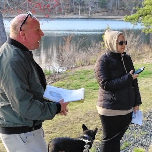 Plan calls for upgrades to Silver Lake in Athol
 Magic comes to Red Apple in Phillipston
 Parents question handling of threat at Erving Elementary School
 On The Ridge with Joe Judd: What time should you turkey hunt?
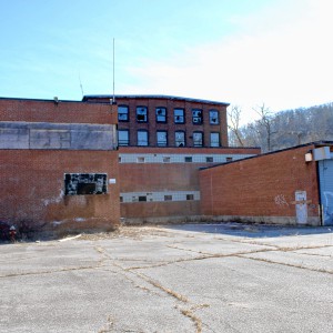 Erving rejects trade school’s incomplete proposal for mill reuse
 Orange man gets 12 to 14 years for child rape
Editors Picks
 Sportsman’s Corner: Turkey time
 With eye toward teaching firearm safety, Mahar’s Junior ROTC adding air rifles
 Mass. saw nearly 200 percent rise in antisemitic incidents last year
 North Quabbin Notes, April 23
Sports

Track & field: Greenfield, Mohawk Trail split dual meet
It was a dual meet split for the Greenfield and Mohawk Trail track and field teams on Thursday.The Greenfield boys captured a 90-54 victory over the Warriors while the Mohawk Trail girls snagged a 123-18 victory over the Wave.Here are the winners from...
 Country Club of Greenfield holding Youth Golf Camp June 24-27
Opinion

My Turn: A moral justification for civil disobedience to abortion bans
Over the last several years, in response to abortion bans and restrictions, advocates around the country have developed an alternative supply network for abortion pills outside of the medical system and the law.As a lawyer and law-abiding citizen, I...
 Guest columnist Rudy Perkins: Dangerous resolution on Iran
 Guest columnists Ellen Attaliades and Lynn Ireland: Housing crisis is fueling the human services crisis
 My Turn: April is second chance month

Police Logs

Athol Police Logs: March 12 to March 19
ATHOL POLICE LOGSTuesday, March 126:45 p.m. - Male party into the lobby regarding a shop vac he lent to someone and they are refusing to give it back. Party was advised of his options. Attempted to contact involved party, negative contact, a voicemail...
 Athol Police Logs: Feb 19 to Feb. 27
 Athol Police Log Feb. 4-18
 Orange Police Log 12/1-13
 Athol Police Log 11/8-26
Arts & Life

Proof that it’s never too late: Solo exhibit and free workshops honor the late Frederick Gao, a Belchertown resident who became a painter in his last five years
For the months of May and June, the Sunderland Public Library’s Lane Family Reading Room Gallery will turn into a fount of inspiration, as the library honors the work of a late-blooming artist.Through “Awing & Honoring Frederick Gao,” the library will...
Obituaries
 Mary M. Thompson
Mary M. (Powers) Thompson Dade City, FL - Mary M. (Powers) Thompson passed away unexpectedly on Sunday, April 14, 2024. She was born at Langley Air Force Base, in Hampton VA, on February 17, 1968, the daughter of Robert H. and Joan (Lint... remainder of obit for Mary M. Thompson
 Nancy C. Skowrowski
Nancy C Skowronski Royalston, MA - Nancy C Skowronski, born in Worcester, MA on January 1, 1943, lived a captivating life, filled with vibrant memories and impactful experiences that created a lasting legacy. A resident of Royalston, Mas... remainder of obit for Nancy C. Skowrowski
 Robert E. Thayer
Robert E. "Bob" Thayer Athol, MA - ATHOL - Robert E. "Bob" Thayer, 90 of Athol passed away Sunday, April 14, 2023, in the Athol Hospital. He was born on July 13, 1933, the son of Robert H. Thayer and Louise E. (King) Thayer. Bob graduat... remainder of obit for Robert E. Thayer
 Chris N. Boyle
8/5/1956 - 4/11/2024 ORANGE, MA - Chris Boyle, beloved father and husband, passed away on April 11, 2024 at home. Chris led a life of unwavering dedication to his family, a steadfast commitment to the land he cherished, and a love for ... remainder of obit for Chris N. Boyle

 Federal probe targets UMass response to anti-Arab incidents
 A Page from North Quabbin History: Women of Royalston display
 Spilka pledges ‘comprehensive climate bill’ in Senate
 Senate adds bills to reform electric industry
 High schools: Amy Mihailicenco, Greenfield girls tennis edge Turners Falls (PHOTOS)
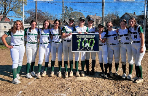 Softball: Turners edges Tech, Greenfield’s Paulin notches 100th hit, Mahar win first game since 2019
 High schools: Lilly Ross records 100th career hit in Franklin Tech’s win over Northampton
 My Turn: Industrial solar installations are overwhelming Northfield neighborhood
 Self-expression on display: ServiceNet members’ artworks on view at Greenfield Public Library through end of May
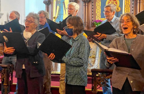 Embracing both new and old: Da Camera Singers celebrates 50 years in the best way they know how
 Time to celebrate kids and books: Mass Kids Lit Fest offers a wealth of programs in Valley during Children’s Book Week
 Sounds Local: A rock circus returns to Turners Falls: The Slambovian Circus of Dreams brings the fun Friday night at the Shea