
A Page from North Quabbin History: The story of the Millers River

Carla Charter pf Phillpston. Paul Franz

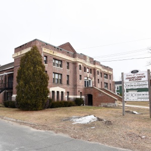
The history and significance of the Millers River will be highlighted by Chris Coyle during his presentation at the Athol Public Library. PHOTO CREDIT/CHRIS COYLE
| Published: 04-21-2024 5:00 PM |
By Carla Charter
The Millers River meanders through both Athol and Orange, carrying with it not only the beauty on its surface, but a long history stretching back to when the river was first formed 25,000 years ago. Local historian Chris Coyle will be speaking on the river, covering its history and significance in his upcoming talk, “Miller’s River-The Jewel of North Central Massachusetts,” on April 23 at the Athol Public Library.
The first people known to be living near the river were the Nipmuc tribe, who fished in the river, hunted along its shores and cultivated land on the river’s floodplains. The Nipmuc named the river Papacontuckquash, a Nipmuc word meaning “split banks river.” The Papacontuckquash is first mentioned in an early Native American deed. A sign on the Athol History Trail commemorates the use of riverbank land by Indigenous people for growing corn and as an area of settlement, according to Coyle.
King Philip Rock, a large glacial erratic, is located in Winchendon along the bank of the Millers River just north of the confluence of the Millers and Otter rivers, according to Coyle. The rock is named for Metacomet (whom the colonists called King Phillip).
“Arrowheads and other artifacts have been found at this site,” Coyle said.
Unknown early European colonists no doubt discovered the river in their exploration of the area.
“Legend has it that the name Miller was given to the river by the early European settlers when a man by the name of Miller was drowned while attempting to cross the river on his way to Northfield,” Coyle stated.
Early colonists used the river in a similar way that the Nipmuc tribe did – fishing in the river, hunting along its shores and cultivating land on the river’s floodplains.
Article continues after...
Yesterday's Most Read Articles
 Orange Selectboard declares armory as surplus property
 DA to announce breakthrough in 1989 unsolved homicide
 1989 homicide victim found in Warwick ID’d through genetic testing, but some mysteries remain
 Sportsman’s Corner: Orange Gun Club’s Kids Derby
 Carol Doucette of Royalston receives $15,000 from Publishers Clearing House
 Michelle Caruso: Questions candidate’s judgment after 1980s police training incident
“Agrarian activity persisted along parts of the Millers River in colonial times for the most part, although the existence of sawmills began to increase,” Coyle said.
In 1825, a study was made to examine the feasibility of constructing a canal through the area for transport. The civil engineer Co. Loami Baldwin was engaged to make a detailed plan, said Coyle.
“However, the era of the railroad arrived before anything came of the canal proposal,” Coyle said.
The building of railroads in the mid-19th century led to more historical events along its banks, such as the tragic train wreck at Long Bridge in the Bearsden area on June 16, 1870, he continued.
Early industrial development along the Millers River took advantage of water power. Most mills and manufacturing concerns located along the banks of the Millers River in the 19th and into the 20th century used water from the river for one purpose or another. In Athol, the Athol Manufacturing Company, Gay and Ward (later Union Twist Drill) and the L.S. Starrett Company all used the river. Remnants of dams mark the sites of former industries.
The massive floods of 1900, 1936 and 1938 resulted in considerable news in the communities along the Millers River. A sign along Route 2 in Farley Flats, Erving, makes note that the flood waters from the 1938 hurricane were 5½ feet above the highway.
Although discharging back into the river was once a common practice, pollution of the Millers River increased to an alarming level as the 20th century wore on, Coyle said. Industrial discharge, municipal and residential sewage were the chief sources of pollution.
“Farmers even began to fence the river to prevent their livestock from drinking from the waste-laden water,” Coyle said.
The Millers River became increasingly used for environmental and recreational purposes in the latter part of the 20th century, particularly after efforts were made to successfully clean up the river to return it to its once pristine state.
Among the recreational uses of the river is the Millers River Rat Race, dating back to March 1964, when several friends bet each other who could go Orange from Athol by canoe the fastest. The annual race has grown steadily over the years to become the spectacular event that is today, Coyle said.
As for the future of the river, Coyle said, “I hope that people will continue to use the Millers River in ways which will preserve the beautiful waterway and the land on its banks for future generations.”
Coyles presentation will be held on April 23 from 6:30-7:30 p.m. at the Athol Public Library. The event is free and open to the public. Registration can be made by calling the library at 978-249-9515 or via athol.librarycalendar.com.
Carla Charter is a freelance writer from Phillipston. Her writing focuses on the history of the North Quabbin area. Contact her at cjfreelancewriter@earthlink.net.
 Upon review, panel not behind any ballot questions